This is my final hike for the month of January. And since I am running out of places to hike, I might be posting less hiking in the following months (I think). There are plenty of places to hike in Malaysia (or Selangor specifically) but I have yet to finalise my own target list (i.e. which hills or mountains that I'd like to try out).
Anyway, we decided to try and hike Bukit Tabur for two reasons; (1) on most of the hiking blogs, almost every one of them would recommend hiking Bukit Tabur; and (2) due to its challenging nature, some blogs have even recommended not to hike Bukit Tabur.
Note: We need a permit to hike Bukit Tabur (although some of the hikers that I met yesterday said they didn't obtain the permit) and here's a link of how to get the permit [click here]. We obtained our permit on Friday from Pejabat Hutan Daerah Selangor on Friday morning. The permit is only RM5 per person.
Bukit Tabur is located in Taman Melawati. I used Waze to get to the entrance of the trail. There are two routes for Bukit Tabur, which are Bukit Tabur East and Bukit Tabur West. Some people have told me that Bukit Tabur East is shorter but more challenging and Bukit Tabur West is not as challenging but the route is longer. Having never hiked on both routes, we decided to try out Bukit Tabur East. So, here's a photoblog of our hike yesterday:

We left for the hike at 9 am (after having breakfast) and arrived at the entrance to Bukit Tabur at around 9.30 am. Parked carefully around the nearby housing area (so as to not disturb any of the residences) and proceeded to our hiking route.

The first few meters from the road, we had to pass by these huge water pipes.

The climb begins.

Initial hike.

This way please. If I'm not mistaken there were a handful of these in the initial hike up.

A little bit of scampering around the rocks.

On several parts of the hike, there are ropes provided to help your climb. Do use gloves because if you don't, you might end up with blisters on your hands.

Some parts had an almost 90 degree incline.

Having a strong upper body strength is definitely an added advantage.

First peak.

Went forward (with some ups and downs) to the main peak.

Some parts of the climb were relatively easy.

The main destination is up this peak.

Almost there.

The final climb up the main peak. 90 degrees incline. One tiny route (thus those going up would have to wait for those coming down to clear the route. As one of my friends had commented, only in Malaysia you would find traffic jam when hiking and you have to wait for your turn to go up.

Climbing up the main peak. Caution: This peak is treacherous. One tiny mistake would definitely cost you your life (or limb). So do be careful.

And we have finally reached the top. Hurrah!

Me, Aatif and Nihal. We finally made it to the top.

The dragon back ridge. Checked!

Another traffic jam. Getting down is equally (if not more) treacherous as going up. One rope and your own imagination on where to put your footing on the rocks.

The route down is different than the route up. So this route is definitely way faster than climbing up.

The final 10 - 15 minutes before arriving to where our car was parked.

Bukit Tabur East.

The view from the top of Bukit Tabur. Masha Allah.

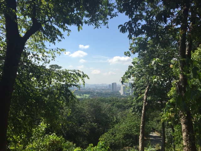
And got to enjoy a beautiful view of the KL skyline as well.
Let me just say that I had my concerns prior to climbing Bukit Tabur, one of the is regarding the accidents that has happened on the hill [click here] and some blogs/ write ups that were not favourable (i.e. they warned us against hiking up Bukit Tabur) thus I was initially afraid that climbing Bukit Tabur would be a difficult task. But having hiked up the top, I must say that it's not as difficult as what people say it is. If you've hiked before, then Bukit Tabur is definitely doable. However, do bear in mind that if you have any second thoughts on climbing, feel free to stop your climb and proceed to descend. A hike is always a personal achievement and if you feel you are not up to it, you can always try again later.
In terms of timing, we reached the first peak in about an hour and proceeded to reach the main peak in another hour (it would have been less but because there are so many people, I think we spent maybe around 20 - 30 minutes just waiting for the route to clear up and to give way to those who are descending). And going down took only perhaps 45 minutes because it's a straight (no fuss) route down the hill.
Now that I've climbed Bukit Tabur, I wouldn't say that it's that difficult (although I am not able to say the same for Bukit Tabur West because I have never climbed up that route before). With perseverance, you will definitely be able to make it. On some parts I did feel kind of cheated because I expected the route to be more difficult (so far I would have to say Mulu Pinnacles is the most challenging hike that I've ever been to) but the climb to the final peak of Bukit Tabur is definitely very, very dangerous and do be extra careful if you make the decision to climb up the main peak.
That being said, if you love hiking, Bukit Tabur is definitely a must hike! The hike was enjoyable and the scenery is definitely worth the climb.
xoxo Mrs Fashionista